
File:1751 Anson Map of Baja California and the Pacific, Trade Routes from Acapulco to Manila - Geographicus - MerduSud-anson-1751.jpg

Size of this preview: 799 × 282 pixels. Other resolutions: 320 × 113 pixels | 640 × 226 pixels | 1,024 × 361 pixels | 1,280 × 452 pixels | 2,560 × 904 pixels | 6,000 × 2,118 pixels.
Original file (6,000 × 2,118 pixels, file size: 3.54 MB, MIME type: image/jpeg)
| This is a file from the Wikimedia Commons. Information from its description page there is shown below. Commons is a freely licensed media file repository. You can help. |
Summary
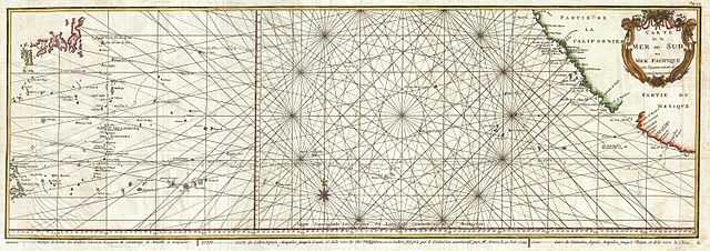
| Carte de la Mer du Sud ou Mer Pacifique entre l'Equateur et le 39 1-2 . De Latitude Septentrionale. | ||||||
|---|---|---|---|---|---|---|
| Artist | ||||||
| Title |
Carte de la Mer du Sud ou Mer Pacifique entre l'Equateur et le 39 1-2 . De Latitude Septentrionale. |
|||||
| Description |
English: This is a rare 1750 nautical chart of the Pacific Ocean by the French map publisher N. Bellin.
|
|||||
| Date | 1750 (undated) | |||||
| Dimensions | height: 12 in (30.4 cm); width: 34 in (86.3 cm) | |||||
| Accession number |
Geographicus link: MerduSud-anson-1751 |
|||||
| Source/Photographer |
Anson, G., Voyage Autour du Monde, Fait Dans Les anees 1740, 41, 42, 43, & 44, 1751 Paris Edition.
|
|||||
| Permission (Reusing this file) |
|
|||||
File history
Click on a date/time to view the file as it appeared at that time.
| Date/Time | Thumbnail | Dimensions | User | Comment | |
|---|---|---|---|---|---|
| current | 22:29, 23 March 2011 | 6,000 × 2,118 (3.54 MB) | BotMultichillT | {{subst:User:Multichill/Geographicus |link=http://www.geographicus.com/P/AntiqueMap/MerduSud-anson-1751 |product_name=1751 Anson Map of Baja California and the Pacific, Trade Routes from Acapulco to Manila |map_title=Carte de la Mer du Sud ou Mer Pacifiqu |
File usage
The following pages on the English Wikipedia use this file (pages on other projects are not listed):
Global file usage
The following other wikis use this file:
- Usage on de.wikipedia.org
- Usage on hy.wikipedia.org